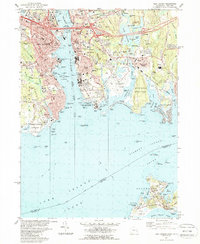
1984 Map of New London
USGS Topo · Published 1988About this map
Thames River maritime activity and coastal defense dominate this mid-1980s look at the Connecticut shoreline. The map shows the established institutional footprint of the U S Coast Guard Academy and the Fort Trumbull Usn Res facing one another across the water from New London and Groton. Extensive shoreline detail includes the New London Harbor and the New London Ledge Lighthouse marking the approach from Long Island Sound. To the east, the landscape transitions from industrial and residential zones to the preserved reaches of Bluff Point State Park and Haley Farm State Park. Further offshore, the northern tip of Fishers Island is visible, featuring Elizabeth Field and the Naval Underwater Systems Center, highlighting the area's strategic importance during the late Cold War period.
Find a feature on this map
106 named features on this map. Tap any name to fly to it.
Don’t see what you’re looking for? This feature index may not catch every label — zoom into the map to look around manually.
Map Details
Editions of this 1984 New London Map
2 editions found
Other maps of this area

1889 · Stonington
USGS Topo · 1:62,500

1892 · New London
USGS Topo · 1:62,500

1893 · Stonington
USGS Topo · 1:62,500

1893 · New London
USGS Topo · 1:62,500

1903 · Gardiners Island
USGS Topo · 1:62,500

1904 · Gardiners Island
USGS Topo · 1:62,500

1904 · Montauk
USGS Topo · 1:62,500

1921 · Gardiners Island
USGS Topo · 1:62,500

1921 · New London
USGS Topo · 1:62,500

1921 · Stonington
USGS Topo · 1:62,500