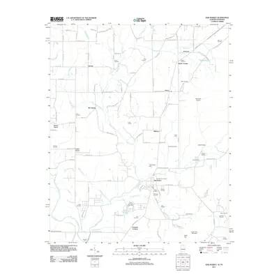
2011 Map of New Market
USGS Topo · Published 2011About this map
New Market serves as the hub for this portion of northeastern Madison County, situated where the Mountain Fork and Rodgers Branch converge. The landscape is defined by its deep agricultural and genealogical roots, evidenced by the high density of family burial grounds such as Britton Cemetery, Hambrick Cemetery, and Steele Cemetery. Small, distinct communities like Plevna, Mint Spring, and Hillsboro are scattered across the terrain, linked by a network of rural roads that often follow the meandering paths of waterways like Hester Creek. Along the southern edge, the Flint River marks a significant geographic boundary near Bloucher Ford. The presence of features like Jimmy Johnston Lake and Milner Pond indicates a reliance on local water resources, while the naming of crossings like Steele Crossing and Fannings Crossing suggests a long history of established transit points through the valley.
Find a feature on this map
119 named features on this map. Tap any name to fly to it.
Don’t see what you’re looking for? This feature index may not catch every label — zoom into the map to look around manually.
Map Details
Editions of this 2011 New Market Map
This is the sole edition of this map. No revisions or reprints were ever made.
Other maps of this area

1888 · Scottsboro
USGS Topo · 1:125,000

1888 · Huntsville
USGS Topo · 1:125,000

1892 · Huntsville
USGS Topo · 1:125,000

1892 · Scottsboro
USGS Topo · 1:125,000

1936 · King Cove
USGS Topo · 1:24,000

1936 · Flintville
USGS Topo · 1:24,000

1936 · Meridianville
USGS Topo · 1:24,000

1936 · Fisk
USGS Topo · 1:24,000

1936 · Hollytree
USGS Topo · 1:24,000

1936 · Lincoln
USGS Topo · 1:24,000