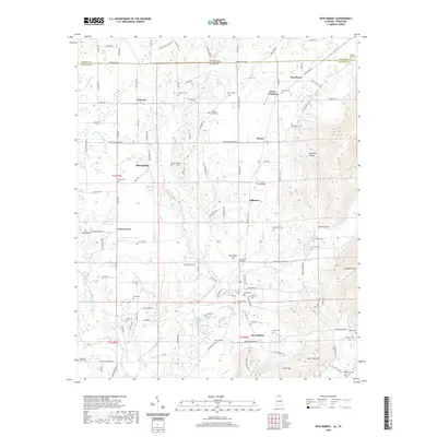
2020 Map of New Market
USGS Topo · Published 2020About this map
New Market anchors the southern portion of this landscape where the Flint River begins its course through northern Alabama. Along the border of Tennessee and Alabama, a series of small rural communities like Plevna, Mint Spring, and Hillsboro are connected by the historical winding route of Winchester Rd. The area is characterized by family-named landmarks and many burial grounds, including the State Line Cem and Graveyard Hill Cem, reflecting generations of local settlement. To the east, the terrain rises into the distinctive ridges of Backbone Mtn and Cedar Gap Mtn, while the lowlands are drained by the Mountain Fork and Hester Cr. This survey captures the transition from the fertile river bottoms to the wooded slopes of the Tennessee Valley foothills, preserving the locations of numerous small family cemeteries like the Jiles Cem and Britton Cem.
Find a feature on this map
129 named features on this map. Tap any name to fly to it.
Don’t see what you’re looking for? This feature index may not catch every label — zoom into the map to look around manually.
Map Details
Editions of this 2020 New Market Map
This is the sole edition of this map. No revisions or reprints were ever made.
Other maps of this area

1888 · Scottsboro
USGS Topo · 1:125,000

1888 · Huntsville
USGS Topo · 1:125,000

1892 · Huntsville
USGS Topo · 1:125,000

1892 · Scottsboro
USGS Topo · 1:125,000

1936 · King Cove
USGS Topo · 1:24,000

1936 · Flintville
USGS Topo · 1:24,000

1936 · Meridianville
USGS Topo · 1:24,000

1936 · Fisk
USGS Topo · 1:24,000

1936 · Hollytree
USGS Topo · 1:24,000

1936 · Lincoln
USGS Topo · 1:24,000