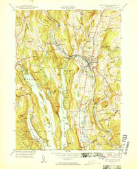
1951 Map of New Milford
USGS Topo · Published 1951About this map
Candlewood Lake dominates the central landscape, showing the complex shoreline and numerous islands of this massive man-made reservoir shortly after its creation. The topography follows the Housatonic River valley, where the New Haven and Hartford RR traces the riverbank through the regional hub of New Milford. Notable industrial and infrastructure markers include The Lime Kiln near Boardman Bridge, a Hydroelectric Plant, and the Candlewood Lookout Tower perched on the ridge of Green Pond Mtn.
Find a feature on this map
112 named features on this map. Tap any name to fly to it.
Don’t see what you’re looking for? This feature index may not catch every label — zoom into the map to look around manually.
Map Details
Editions of this 1951 New Milford Map
2 editions found
Other maps of this area

1892 · Danbury
USGS Topo · 1:62,500

1892 · New Milford
USGS Topo · 1:62,500

1892 · Carmel
USGS Topo · 1:62,500

1893 · Carmel
USGS Topo · 1:62,500

1893 · New Milford
USGS Topo · 1:62,500

1893 · Clove
USGS Topo · 1:62,500

1894 · Clove
USGS Topo · 1:62,500

1894 · Carmel
USGS Topo · 1:62,500

1898 · Clove
USGS Topo · 1:62,500

1901 · Clove
USGS Topo · 1:62,500