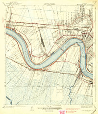
1938 Map of New Orleans West
USGS Topo · Published 1938About this map
The Mississippi River winds in a dramatic serpentine curve through this mid-1930s landscape, serving as the central axis for a region in transition. The west bank remains heavily defined by drainage canals like the Westwego Drainage Canal and the large agricultural holdings of Churchill Farms, while the east bank shows the rapid suburbanization of Jefferson Parish following the arrival of the Air Line Highway. Transportation infrastructure dominates the area, anchored by the massive Huey P Long Bridge and a dense network of competing rail lines including the Illinois Central Railroad and the Southern Pacific. Local life is visible in the emergence of neighborhoods such as Metairie and Bonnabel Place, alongside specialized sites like the Wedell-Williams Airport and the U S Marine Hospital, reflecting the growing importance of aviation and public services in this era.
Find a feature on this map
55 named features on this map. Tap any name to fly to it.
Don’t see what you’re looking for? This feature index may not catch every label — zoom into the map to look around manually.
Map Details
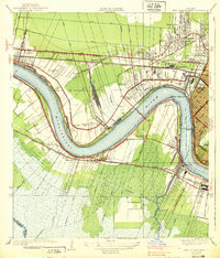
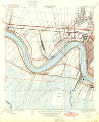
Editions of this 1938 New Orleans West Map
3 editions found
Other maps of this area

1891 · Hahnville
USGS Topo · 1:62,500

1891 · Spanish Fort
USGS Topo · 1:62,500

1891 · New Orleans
USGS Topo · 1:62,500

1892 · Bonnet Carre
USGS Topo · 1:62,500

1932 · New Orleans NE
USGS Topo · 1:31,680

1932 · New Orleans NW
USGS Topo · 1:31,680

1932 · New Orleans SE
USGS Topo · 1:31,680

1932 · New Orleans SW
USGS Topo · 1:31,680

1932 · Hahnville NE
USGS Topo · 1:31,680

1935 · Luling
USGS Topo · 1:31,680