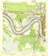
1938 Map of New Orleans West
USGS Topo · Published 1938About this map
The Mississippi River creates a massive oxbow at Twelvemile Pt and Ninemile Pt, anchoring a landscape defined by New Orleans' westward expansion. This mid-1930s era shows the critical role of rail and river infrastructure, dominated by the newly constructed Huey P Long Bridge spanning the water to connect Jefferson Heights with the industrial corridor of Belt City. North of the river, the residential development of Metairie and Bonnabel Place is clearly delineated alongside the Air Line Highway, while the vast Churchill Farms remains largely open south of Westwego. Local institutional history is visible through landmarks such as the U S Marine Hospital and the Water Purification Plant near the parish line. The complex rail network, including the Illinois Central and Southern Pacific, weaves through established settlements like Kenner and Harahan, reflecting the region's industrial backbone.
Find a feature on this map
77 named features on this map. Tap any name to fly to it.
Don’t see what you’re looking for? This feature index may not catch every label — zoom into the map to look around manually.
Map Details
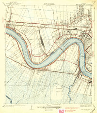
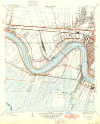
Editions of this 1938 New Orleans West Map
3 editions found
Other maps of this area

1891 · Hahnville
USGS Topo · 1:62,500

1891 · Spanish Fort
USGS Topo · 1:62,500

1891 · New Orleans
USGS Topo · 1:62,500

1892 · Bonnet Carre
USGS Topo · 1:62,500

1932 · New Orleans NE
USGS Topo · 1:31,680

1932 · New Orleans NW
USGS Topo · 1:31,680

1932 · New Orleans SE
USGS Topo · 1:31,680

1932 · New Orleans SW
USGS Topo · 1:31,680

1932 · Hahnville NE
USGS Topo · 1:31,680

1935 · Luling
USGS Topo · 1:31,680