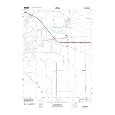
2010 Map of New Paris
USGS Topo · Published 2010About this map
New Paris sits at the northern end of this corridor along the Indiana-Ohio border, where the East Fork Whitewater River meets Silver Lake and the Rocky Fork tributary. The landscape is a network of rural settlements and agricultural interests, including Wesler Orchards and the small hamlet of New Westville. Geographically, the area is defined by its drainages, with Elkhorn Creek winding south toward Elkhorn Falls and Four Mile Creek cutting across the southeastern corner near Campbellstown. Local history researchers will find several burial grounds documented, such as State Line Cemetery and Spring Lawn Cemetery, reflecting the long-established communities that transitioned into the early 21st century. The southern portion of the quadrangle is dominated by the sprawling grounds of the Richmond Municipal Airport, highlighting the modern transport infrastructure alongside historic routes like Old National Road E.
Find a feature on this map
69 named features on this map. Tap any name to fly to it.
Don’t see what you’re looking for? This feature index may not catch every label — zoom into the map to look around manually.
Map Details
Editions of this 2010 New Paris Map
This is the sole edition of this map. No revisions or reprints were ever made.
Other maps of this area

1911 · Oxford
USGS Topo · 1:62,500

1915 · New Paris
USGS Topo · 1:48,000

1915 · College Corner
USGS Topo · 1:48,000

1918 · College Corner
USGS Topo · 1:62,500

1918 · New Paris
USGS Topo · 1:62,500

1953 · Cincinnati
USGS Topo · 1:250,000

1957 · Cincinnati
USGS Topo · 1:250,000

1960 · New Madison
USGS Topo · 1:24,000

1960 · Liberty
USGS Topo · 1:24,000

1960 · Fairhaven
USGS Topo · 1:24,000