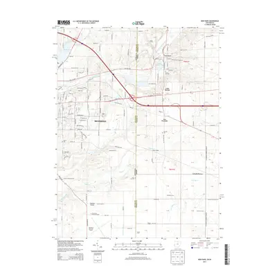
2013 Map of New Paris
USGS Topo · Published 2013About this map
The Indiana-Ohio state line bisects this 2013 survey, where the suburban fringes of Richmond meet the agricultural lands of Wayne and Preble counties. The landscape is defined by the drainage of the East Fork Whitewater River and several smaller streams like Elkhorn Creek and Rocky Fork. The settlement pattern reflects a mix of established towns and family-held agricultural lands, including Terrebonne Farms, Straszheim Farms, and Wesler Orchards. Notable community landmarks range from historical burial sites like Spring Lawn Cem and Westville Cem to modern infrastructure such as the Richmond Municipal Airport. The map also captures several distinct hamlets like New Westville and Cedar Springs, along with recreational and industrial features including the Forest Hills Golf Course and a Gravel Pit along the river.
Find a feature on this map
157 named features on this map. Tap any name to fly to it.
Don’t see what you’re looking for? This feature index may not catch every label — zoom into the map to look around manually.
Map Details
Editions of this 2013 New Paris Map
This is the sole edition of this map. No revisions or reprints were ever made.
Other maps of this area

1911 · Oxford
USGS Topo · 1:62,500

1915 · New Paris
USGS Topo · 1:48,000

1915 · College Corner
USGS Topo · 1:48,000

1918 · College Corner
USGS Topo · 1:62,500

1918 · New Paris
USGS Topo · 1:62,500

1953 · Cincinnati
USGS Topo · 1:250,000

1957 · Cincinnati
USGS Topo · 1:250,000

1960 · New Madison
USGS Topo · 1:24,000

1960 · Liberty
USGS Topo · 1:24,000

1960 · Fairhaven
USGS Topo · 1:24,000