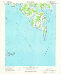
1964 Map of New Point Comfort
USGS Topo · Published 1966About this map
The tidal inlets and marshlands of Mathews County define this coastal landscape as it appeared in the mid-1960s. Low-lying terrain is punctuated by small settlements like Motorun, Bayside, and Shadow, where local life centered around the numerous creeks and harbors. At the southernmost tip, New Point Comfort serves as a critical navigation landmark, anchored by the New Point Comfort Lighthouse overlooking the confluence of Mobjack Bay and the Chesapeake Bay.
Find a feature on this map
44 named features on this map. Tap any name to fly to it.
Don’t see what you’re looking for? This feature index may not catch every label — zoom into the map to look around manually.
Map Details
Editions of this 1964 New Point Comfort Map
2 editions found
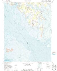
Other maps of this area

1907 · Hampton
USGS Topo · 1:62,500

1916 · Mathews
USGS Topo · 1:62,500

1917 · Mathews
USGS Topo · 1:62,500

1943 · Richmond
USGS Topo · 1:250,000

1944 · Messick
USGS Topo · 1:24,000

1944 · Harris Grove
USGS Topo · 1:24,000

1948 · Ware Neck
USGS Topo · 1:24,000

1948 · Achilles
USGS Topo · 1:24,000

1948 · New Point Comfort
USGS Topo · 1:24,000

1948 · Mathews
USGS Topo · 1:24,000