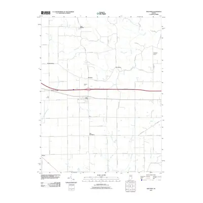
2010 Map of New Point
USGS Topo · Published 2010About this map
New Point sits at the heart of this rural Indiana landscape, where local agriculture and small-scale aviation intersect. The area is defined by a series of long-established crossroads communities including Saint Maurice, Enochsburg, and Rossburg, many of which maintain their identity through local landmarks and ancestral burial grounds like Maple Cemetery and Ross Cemetery. The terrain is drained by a network of waterways, most notably Salt Creek and the Vernon Fork Muscatatuck River, which carve subtle paths through the grid of county roads.
Find a feature on this map
69 named features on this map. Tap any name to fly to it.
Don’t see what you’re looking for? This feature index may not catch every label — zoom into the map to look around manually.
Map Details
Editions of this 2010 New Point Map
This is the sole edition of this map. No revisions or reprints were ever made.
Other maps of this area

1946 · Pierceville
USGS Topo · 1:24,000

1946 · Batesville
USGS Topo · 1:24,000

1946 · Osgood
USGS Topo · 1:24,000

1946 · New Point
USGS Topo · 1:24,000

1953 · Cincinnati
USGS Topo · 1:250,000

1956 · Metamora
USGS Topo · 1:24,000

1957 · Cincinnati
USGS Topo · 1:250,000

1958 · Greensburg
USGS Topo · 1:24,000

1958 · Millhousen
USGS Topo · 1:24,000

1958 · Clarksburg
USGS Topo · 1:24,000