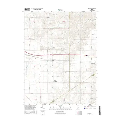
2016 Map of New Point
USGS Topo · Published 2016About this map
Saint Maurice and Enochsburg anchor the northern reaches of this rural landscape where the headwaters of Salt Creek and Laughery Creek divide the drainage basins of southeastern Indiana. The map captures a transition from the structured agricultural grid in the west, near Mechanicsburg and Rossburg, to the more dissected terrain of the east. Near the center, New Point serves as a local hub along the rail corridor, while New Pennington sits further south near the intersection of several county lines. This 2016 survey documents the enduring layout of rural cemeteries like Maple Cem and Ross Cem, which offer significant genealogical value for researchers of Decatur and Franklin counties. On the eastern margin, the expansion of Batesville and the presence of the Batesville Airport signal the modern industrial and transportation developments influencing this traditionally agrarian region.
Find a feature on this map
77 named features on this map. Tap any name to fly to it.
Don’t see what you’re looking for? This feature index may not catch every label — zoom into the map to look around manually.
Map Details
Editions of this 2016 New Point Map
This is the sole edition of this map. No revisions or reprints were ever made.
Other maps of this area

1946 · Pierceville
USGS Topo · 1:24,000

1946 · Batesville
USGS Topo · 1:24,000

1946 · Osgood
USGS Topo · 1:24,000

1946 · New Point
USGS Topo · 1:24,000

1953 · Cincinnati
USGS Topo · 1:250,000

1956 · Metamora
USGS Topo · 1:24,000

1957 · Cincinnati
USGS Topo · 1:250,000

1958 · Greensburg
USGS Topo · 1:24,000

1958 · Millhousen
USGS Topo · 1:24,000

1958 · Clarksburg
USGS Topo · 1:24,000