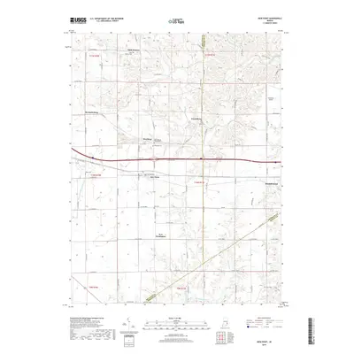
2019 Map of New Point
USGS Topo · Published 2019About this map
New Point serves as a central hub in this Southeastern Indiana landscape, situated where Decatur, Franklin, and Ripley counties converge. The area is defined by a dense network of country roads, such as E Base Rd and Mid Rd, which connect small agricultural settlements and historically significant sites. Genealogists will find a high concentration of burial grounds, including the Saint Maurice Cem in the north and the Old Rossburg Church Cem near Rossburg. The topography is shaped by the drainage patterns of Salt Creek and Laughery Creek, which carve through the terrain near Enochsburg. To the east, the edge of Batesville is visible, supported by the Batesville Airport, marking a transition from the rural character of New Pennington to more developed surroundings.
Find a feature on this map
81 named features on this map. Tap any name to fly to it.
Don’t see what you’re looking for? This feature index may not catch every label — zoom into the map to look around manually.
Map Details
Editions of this 2019 New Point Map
This is the sole edition of this map. No revisions or reprints were ever made.
Other maps of this area

1946 · Pierceville
USGS Topo · 1:24,000

1946 · Batesville
USGS Topo · 1:24,000

1946 · Osgood
USGS Topo · 1:24,000

1946 · New Point
USGS Topo · 1:24,000

1953 · Cincinnati
USGS Topo · 1:250,000

1956 · Metamora
USGS Topo · 1:24,000

1957 · Cincinnati
USGS Topo · 1:250,000

1958 · Greensburg
USGS Topo · 1:24,000

1958 · Millhousen
USGS Topo · 1:24,000

1958 · Clarksburg
USGS Topo · 1:24,000