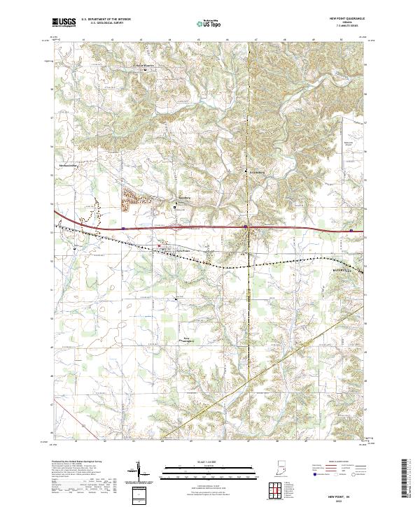
2022 Map of New Point
USGS Topo · Published 2022About this map
New Point sits at the heart of this Decatur County landscape, serving as a central hub for the surrounding agricultural communities. The terrain is defined by the branching waterways of Salt Cr and Tub Cr, which carve through the till plains to the north. To the east, the boundary between Decatur and Franklin counties cuts through Enochsburg, while the southern reaches are marked by the winding course of Laughery Creek.
Find a feature on this map
83 named features on this map. Tap any name to fly to it.
Don’t see what you’re looking for? This feature index may not catch every label — zoom into the map to look around manually.
Map Details
Editions of this 2022 New Point Map
This is the sole edition of this map. No revisions or reprints were ever made.
Other maps of this area

1946 · Pierceville
USGS Topo · 1:24,000

1946 · Batesville
USGS Topo · 1:24,000

1946 · Osgood
USGS Topo · 1:24,000

1946 · New Point
USGS Topo · 1:24,000

1953 · Cincinnati
USGS Topo · 1:250,000

1956 · Metamora
USGS Topo · 1:24,000

1957 · Cincinnati
USGS Topo · 1:250,000

1958 · Greensburg
USGS Topo · 1:24,000

1958 · Millhousen
USGS Topo · 1:24,000

1958 · Clarksburg
USGS Topo · 1:24,000