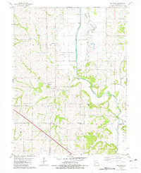
1981 Map of New Point
USGS Topo · Published 1982About this map
The Nodaway River meanders across this rural landscape, defining the jagged boundary between Andrew and Holt counties. This 1981 survey reveals a settlement pattern dominated by the central community of New Point, which serves as a landmark for the surrounding townships of Hickory, Clay, and Lewis. The topography is marked by a complex network of waterways, including the winding Old Channel and various drainage streams like Hog Creek and Arapahoe Creek that carve through the agricultural uplands.
Find a feature on this map
23 named features on this map. Tap any name to fly to it.
Don’t see what you’re looking for? This feature index may not catch every label — zoom into the map to look around manually.
Map Details
Editions of this 1981 New Point Map
This is the sole edition of this map. No revisions or reprints were ever made.
Other maps of this area

1885 · Atchison
USGS Topo · 1:125,000

1888 · Atchison
USGS Topo · 1:125,000

1893 · Atchison
USGS Topo · 1:125,000

1924 · St. Joseph
USGS Topo · 1:62,500

1926 · Saint Joseph
USGS Topo · 1:62,500

1926 · Oregon
USGS Topo · 1:62,500

1926 · Maitland
USGS Topo · 1:62,500

1927 · Bolckow
USGS Topo · 1:62,500

1945 · Bolckow
USGS Topo · 1:62,500

1950 · Kansas City
USGS Topo · 1:250,000