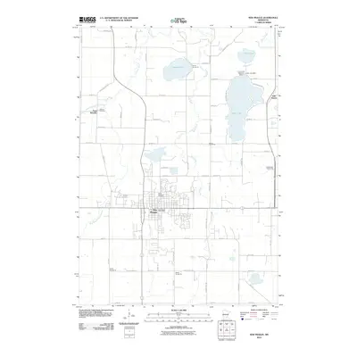
2010 Map of New Prague
USGS Topo · Published 2010About this map
New Prague serves as the central hub of this 2010 survey, showing the city's modern street grid and municipal landmarks like the New Prague Post Office and the prominent Sancti Wenceslai Cemetery. The surrounding landscape is characterized by a network of waterways and glacial lakes, including the large Cedar Lake to the east and Pleasant Lake to the north. These water bodies are connected by a system of winding streams such as Sand Creek and Raven Stream.
Find a feature on this map
68 named features on this map. Tap any name to fly to it.
Don’t see what you’re looking for? This feature index may not catch every label — zoom into the map to look around manually.
Map Details
Editions of this 2010 New Prague Map
This is the sole edition of this map. No revisions or reprints were ever made.
Other maps of this area

1953 · Saint Paul
USGS Topo · 1:250,000

1957 · Prior Lake
USGS Topo · 1:62,500

1957 · New Prague
USGS Topo · 1:62,500

1959 · Saint Paul
USGS Topo · 1:250,000

1960 · Lonsdale
USGS Topo · 1:24,000

1966 · Montgomery
USGS Topo · 1:24,000

1966 · Le Center
USGS Topo · 1:24,000
1974 · Prior Lake
USGS Topo · 1:24,000
1974 · Veseli
USGS Topo · 1:24,000
1981 · New Prague
USGS Topo · 1:24,000