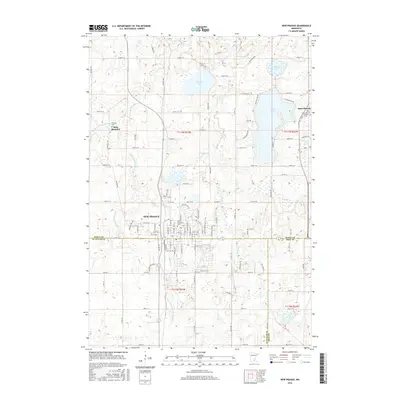
2016 Map of New Prague
USGS Topo · Published 2016About this map
New Prague sits at the convergence of Scott, Le Sueur, and Rice counties, showing its established street grid and expansion north of the municipal center in this 2016 record. The landscape is defined by the glacial till of the region, featuring a dense network of water bodies such as Cedar Lake, Pleasant Lake, and Hickey Lake. Small rural communities and religious outposts like Saint Benedict and Saint Patrick remain distinct landmarks in the surrounding countryside, each anchored by local history as evidenced by the Catholic Cem and Saint Patrick Catholic Cem.
Find a feature on this map
70 named features on this map. Tap any name to fly to it.
Don’t see what you’re looking for? This feature index may not catch every label — zoom into the map to look around manually.
Map Details
Editions of this 2016 New Prague Map
This is the sole edition of this map. No revisions or reprints were ever made.
Other maps of this area

1953 · Saint Paul
USGS Topo · 1:250,000

1957 · Prior Lake
USGS Topo · 1:62,500

1957 · New Prague
USGS Topo · 1:62,500

1959 · Saint Paul
USGS Topo · 1:250,000

1960 · Lonsdale
USGS Topo · 1:24,000

1966 · Montgomery
USGS Topo · 1:24,000

1966 · Le Center
USGS Topo · 1:24,000
1974 · Prior Lake
USGS Topo · 1:24,000
1974 · Veseli
USGS Topo · 1:24,000
1981 · New Prague
USGS Topo · 1:24,000