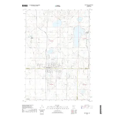
2019 Map of New Prague
USGS Topo · Published 2019About this map
New Prague sits at the convergence of Scott, Le Sueur, and Rice counties, serving as a regional hub defined by its religious landmarks and agricultural surroundings. The landscape is dotted with Catholic heritage sites, including the prominent Saint Wenceslaus church and its associated Saint Wenceslaus Cem, alongside the outlying settlements of Saint Benedict and Saint Patrick. These communities are connected by a network of rural roads such as Helena Blvd and Baseline Blvd, which navigate a terrain carved by the Raven Stream and its various branches.
Find a feature on this map
124 named features on this map. Tap any name to fly to it.
Don’t see what you’re looking for? This feature index may not catch every label — zoom into the map to look around manually.
Map Details
Editions of this 2019 New Prague Map
This is the sole edition of this map. No revisions or reprints were ever made.
Other maps of this area

1953 · Saint Paul
USGS Topo · 1:250,000

1957 · Prior Lake
USGS Topo · 1:62,500

1957 · New Prague
USGS Topo · 1:62,500

1959 · Saint Paul
USGS Topo · 1:250,000

1960 · Lonsdale
USGS Topo · 1:24,000

1966 · Montgomery
USGS Topo · 1:24,000

1966 · Le Center
USGS Topo · 1:24,000
1974 · Prior Lake
USGS Topo · 1:24,000
1974 · Veseli
USGS Topo · 1:24,000
1981 · New Prague
USGS Topo · 1:24,000