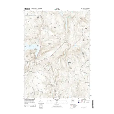
2015 Map of New Preston
USGS Topo · Published 2015About this map
Lake Waramaug serves as a western anchor for this section of Litchfield County, where the hills rise steeply from the water's edge at Mt Bushnell and Tinker Hill. The Shepaug River valley carves through the center of the landscape, feeding into the Upper Shepaug Reservoir and Shepaug Reservoir, which dominate the central corridor. The drainage patterns of Bee Brook and Mallory Brook illustrate the high relief that defined the historic agricultural and milling potential of settlements like Washington and New Preston.
Find a feature on this map
170 named features on this map. Tap any name to fly to it.
Don’t see what you’re looking for? This feature index may not catch every label — zoom into the map to look around manually.
Map Details
Editions of this 2015 New Preston Map
This is the sole edition of this map. No revisions or reprints were ever made.
Other maps of this area

1892 · Winsted
USGS Topo · 1:62,500

1892 · Cornwall
USGS Topo · 1:62,500

1892 · New Milford
USGS Topo · 1:62,500

1893 · Waterbury
USGS Topo · 1:62,500

1893 · New Milford
USGS Topo · 1:62,500

1893 · Cornwall
USGS Topo · 1:62,500

1903 · Cornwall
USGS Topo · 1:62,500

1904 · New Milford
USGS Topo · 1:62,500

1904 · Waterbury
USGS Topo · 1:62,500

1904 · Litchfield
USGS Topo · 1:125,000