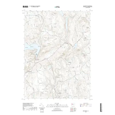
2018 Map of New Preston
USGS Topo · Published 2018About this map
Lake Waramaug anchors the western edge of this Litchfield County landscape, where the Aspetuck River drains south toward New Preston and Marble Dale. The terrain is defined by a dense network of high points, including Above All, Mt Bushnell, and Mount Tom, which reflect the complex topography of the Northwest Hills. Early settlements like Washington and Warren are connected by historical thoroughfares such as the Litchfield Tpke, while smaller hamlets like Woodville and Romford remain tucked into the river valleys.
Find a feature on this map
161 named features on this map. Tap any name to fly to it.
Don’t see what you’re looking for? This feature index may not catch every label — zoom into the map to look around manually.
Map Details
Editions of this 2018 New Preston Map
This is the sole edition of this map. No revisions or reprints were ever made.
Other maps of this area

1892 · Winsted
USGS Topo · 1:62,500

1892 · Cornwall
USGS Topo · 1:62,500

1892 · New Milford
USGS Topo · 1:62,500

1893 · Waterbury
USGS Topo · 1:62,500

1893 · New Milford
USGS Topo · 1:62,500

1893 · Cornwall
USGS Topo · 1:62,500

1903 · Cornwall
USGS Topo · 1:62,500

1904 · New Milford
USGS Topo · 1:62,500

1904 · Waterbury
USGS Topo · 1:62,500

1904 · Litchfield
USGS Topo · 1:125,000