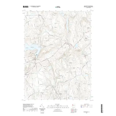
2021 Map of New Preston
USGS Topo · Published 2021About this map
Washington and the surrounding Litchfield County uplands are defined by a network of narrow river valleys and glacial hills, seen here in a 2021 topographic perspective. The Shepaug River flows southward through the center of the sheet, connecting the Upper Shepaug Reservoir and Shepaug Reservoir with the smaller settlements of Woodville and Romford. To the west, the village of New Preston sits near the southern shore of Lake Waramaug, a major geographical feature with landmarks like Arrow Point and Randalls Point.
Find a feature on this map
171 named features on this map. Tap any name to fly to it.
Don’t see what you’re looking for? This feature index may not catch every label — zoom into the map to look around manually.
Map Details
Editions of this 2021 New Preston Map
This is the sole edition of this map. No revisions or reprints were ever made.
Other maps of this area

1892 · Winsted
USGS Topo · 1:62,500

1892 · Cornwall
USGS Topo · 1:62,500

1892 · New Milford
USGS Topo · 1:62,500

1893 · Waterbury
USGS Topo · 1:62,500

1893 · New Milford
USGS Topo · 1:62,500

1893 · Cornwall
USGS Topo · 1:62,500

1903 · Cornwall
USGS Topo · 1:62,500

1904 · New Milford
USGS Topo · 1:62,500

1904 · Waterbury
USGS Topo · 1:62,500

1904 · Litchfield
USGS Topo · 1:125,000