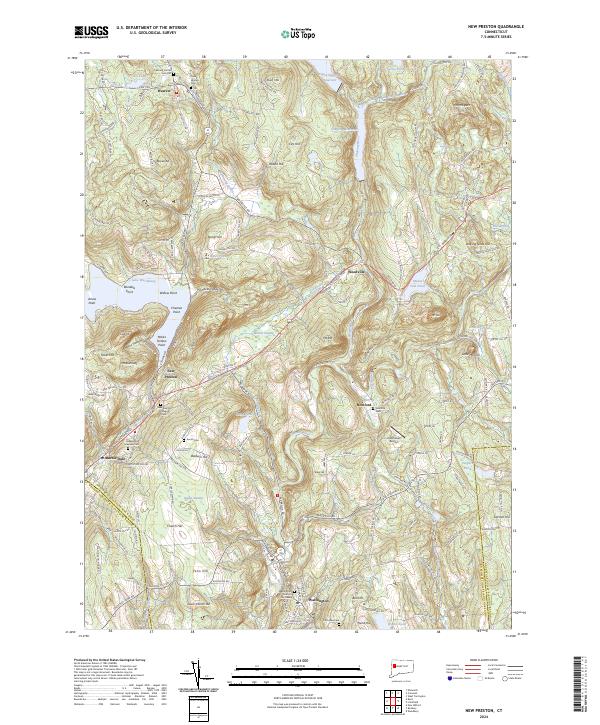
2024 Map of New Preston
USGS Topo · Published 2024About this map
The Litchfield Hills landscape is dominated by the waters of Lake Waramaug and the winding course of the Shepaug River. In this contemporary view of the Connecticut countryside, the area between Warren and Washington reveals a high density of historic burial grounds, including the New Preston Village Cem, Underwood Meadow Cem, and Averill Cem. These sites, alongside the Old Judea Cem near the southern boundary, offer a localized geography for genealogical research and historical preservation.
Find a feature on this map
182 named features on this map. Tap any name to fly to it.
Don’t see what you’re looking for? This feature index may not catch every label — zoom into the map to look around manually.
Map Details
Editions of this 2024 New Preston Map
This is the sole edition of this map. No revisions or reprints were ever made.
Other maps of this area

1892 · Winsted
USGS Topo · 1:62,500

1892 · Cornwall
USGS Topo · 1:62,500

1892 · New Milford
USGS Topo · 1:62,500

1893 · Waterbury
USGS Topo · 1:62,500

1893 · New Milford
USGS Topo · 1:62,500

1893 · Cornwall
USGS Topo · 1:62,500

1903 · Cornwall
USGS Topo · 1:62,500

1904 · New Milford
USGS Topo · 1:62,500

1904 · Waterbury
USGS Topo · 1:62,500

1904 · Litchfield
USGS Topo · 1:125,000