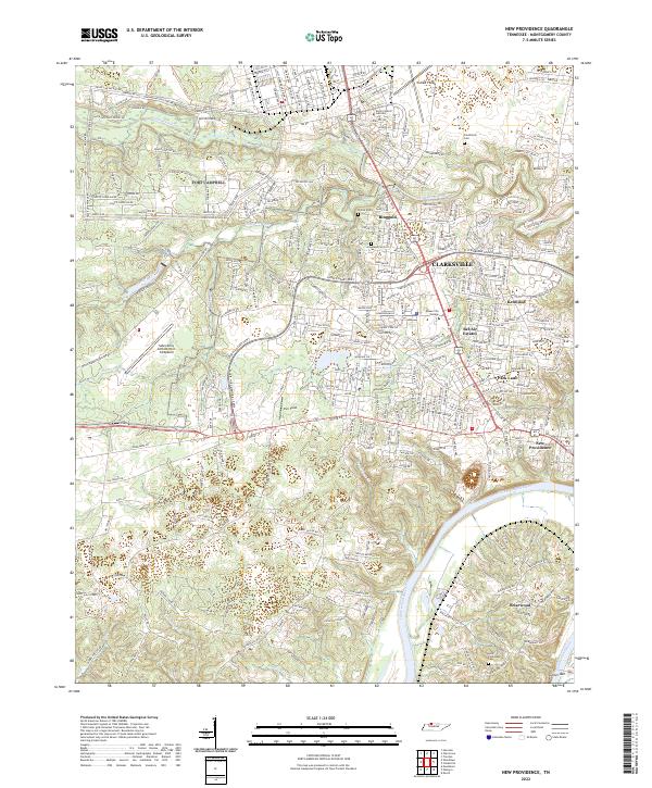
2022 Map of New Providence
USGS Topo · Published 2022About this map
The Cumberland River defines the southern reach of this landscape, with Geiser Bar marking a distinct navigation point along its winding course. The northern half of the area is heavily influenced by military and aviation presence, anchored by the Sabre-Army Airfield (Fort Campbell) and the sprawling military road network including 101st Airborne Division Rd and Fence-Line Patrol Rd. Educational and aviation hubs like the North Central Institute and Outlaw Field characterize the region north of the Ringgold and Clarksville neighborhoods.
Find a feature on this map
320 named features on this map. Tap any name to fly to it.
Don’t see what you’re looking for? This feature index may not catch every label — zoom into the map to look around manually.
Map Details
Editions of this 2022 New Providence Map
This is the sole edition of this map. No revisions or reprints were ever made.
Other maps of this area

1931 · Erin
USGS Topo · 1:62,500

1944 · Clarksville
USGS Topo · 1:50,000

1951 · New Providence
USGS Topo · 1:24,000

1951 · Hammacksville
USGS Topo · 1:24,000

1951 · Clarksville
USGS Topo · 1:24,000

1951 · Herndon
USGS Topo · 1:24,000

1951 · Oak Grove
USGS Topo · 1:24,000

1951 · Woodlawn
USGS Topo · 1:24,000

1956 · Nashville
USGS Topo · 1:250,000

1957 · New Providence
USGS Topo · 1:24,000
Featured Places
- Clarksville, TN
- Briarwood, TN
- Two Rivers District, Clarksville
- New Providence, Clarksville
- Sherwood Forest, Clarksville