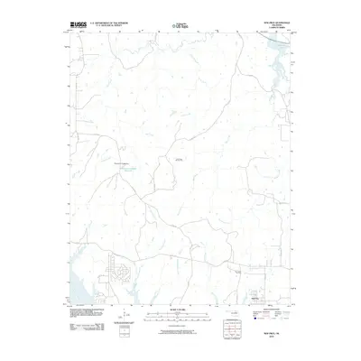
2010 Map of New Prue
USGS Topo · Published 2010About this map
New Prue sits near the southern edge of this Oklahoma landscape, situated just north of the Arkansas River. The area is defined by an extensive drainage system of creeks, including Waresha Creek, Walnut Creek, and Wildhorse Creek, which carve through the terrain. The petroleum industry’s footprint is evident through the East Osage City Oil Field and the Twin Creek Oil Field, highlighting the region's long-standing reliance on resource extraction.
Find a feature on this map
29 named features on this map. Tap any name to fly to it.
Don’t see what you’re looking for? This feature index may not catch every label — zoom into the map to look around manually.
Map Details
Editions of this 2010 New Prue Map
This is the sole edition of this map. No revisions or reprints were ever made.
Other maps of this area

1912 · Hominy
USGS Topo · 1:125,000

1915 · Hominy
USGS Topo · 1:125,000

1915 · Hominy
USGS Topo · 1:62,500

1955 · Enid
USGS Topo · 1:250,000

1958 · Enid
USGS Topo · 1:250,000

1958 · Keystone Dam
USGS Topo · 1:24,000

1958 · Wekiwa
USGS Topo · 1:24,000

1966 · Cleveland
USGS Topo · 1:24,000
1966 · Avant NW
USGS Topo · 1:24,000
1966 · Hominy
USGS Topo · 1:24,000