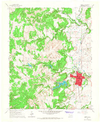
1966 Map of Hominy
USGS Topo · Published 1967About this map
Hominy serves as the focal point of this mid-1960s survey of Osage County, where the town’s urban footprint is closely neighbored by the Indian Village and the industrial infrastructure of the Hominy Oil Field. The Missouri-Kansas-Texas railroad corridor cuts through the landscape, providing a vital link for the region's petroleum and agricultural interests, including several Storage Bins and the Hominy Airport.
Find a feature on this map
41 named features on this map. Tap any name to fly to it.
Don’t see what you’re looking for? This feature index may not catch every label — zoom into the map to look around manually.
Map Details
Editions of this 1966 Hominy Map
2 editions found
Other maps of this area

1909 · Pawhuska
USGS Topo · 1:125,000

1910 · Pawhuska
USGS Topo · 1:125,000

1912 · Hominy
USGS Topo · 1:125,000

1915 · Hominy
USGS Topo · 1:125,000

1915 · Hominy
USGS Topo · 1:62,500

1929 · Skedee
USGS Topo · 1:62,500

1931 · Skedee
USGS Topo · 1:62,500

1932 · Fairfax
USGS Topo · 1:62,500

1955 · Enid
USGS Topo · 1:250,000

1958 · Enid
USGS Topo · 1:250,000