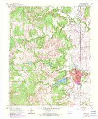
1966 Map of Hominy
USGS Topo · Published 1983About this map
The Osage County town of Hominy serves as the focal point for this survey, revealing the community's layout and surrounding landscape in the mid-1960s with 1980s updates. To the southeast of the main town lies Indian Village, while the local education system is represented by the High Sch and the outlying Mound Valley Sch. The region is defined by an intricate network of waterways, including Hominy Creek, Moshetomoie Creek, and Black Dog Creek, alongside local reservoirs like Municipal Lake and Lake Hominy.
Find a feature on this map
34 named features on this map. Tap any name to fly to it.
Don’t see what you’re looking for? This feature index may not catch every label — zoom into the map to look around manually.
Map Details
Editions of this 1966 Hominy Map
2 editions found
Other maps of this area

1909 · Pawhuska
USGS Topo · 1:125,000

1910 · Pawhuska
USGS Topo · 1:125,000

1912 · Hominy
USGS Topo · 1:125,000

1915 · Hominy
USGS Topo · 1:125,000

1915 · Hominy
USGS Topo · 1:62,500

1929 · Skedee
USGS Topo · 1:62,500

1931 · Skedee
USGS Topo · 1:62,500

1932 · Fairfax
USGS Topo · 1:62,500

1955 · Enid
USGS Topo · 1:250,000

1958 · Enid
USGS Topo · 1:250,000