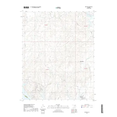
2018 Map of New Prue
USGS Topo · Published 2018About this map
Skiatook and the neighboring settlements of New Prue and Prue occupy a landscape deeply defined by the managed waters of the Osage and Pawnee county line. The topography is dominated by the sprawling northern reach of Keystone Lake and the southeastern finger of Skiatook Lake, connected by a network of drainage systems including Wildhorse Cr and Buck Cr. The residential layout near the Shoreline reveals a mix of rural county roads and themed developments, particularly evident in the cluster of streets like Stagecoach Trl, Frontier Trl, and Covered Wagon Pass. This modern survey illustrates the transition from traditional Oklahoma ranch land to lakeside community life, anchored by points of interest such as Indian Station and the various water management features like the 113060 Reservoir.
Find a feature on this map
47 named features on this map. Tap any name to fly to it.
Don’t see what you’re looking for? This feature index may not catch every label — zoom into the map to look around manually.
Map Details
Editions of this 2018 New Prue Map
This is the sole edition of this map. No revisions or reprints were ever made.
Other maps of this area

1912 · Hominy
USGS Topo · 1:125,000

1915 · Hominy
USGS Topo · 1:125,000

1915 · Hominy
USGS Topo · 1:62,500

1955 · Enid
USGS Topo · 1:250,000

1958 · Enid
USGS Topo · 1:250,000

1958 · Keystone Dam
USGS Topo · 1:24,000

1958 · Wekiwa
USGS Topo · 1:24,000

1966 · Cleveland
USGS Topo · 1:24,000
1966 · Avant NW
USGS Topo · 1:24,000
1966 · Hominy
USGS Topo · 1:24,000