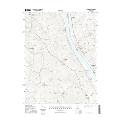
2016 Map of New Richmond
USGS Topo · Published 2016About this map
The Ohio River forms a massive natural boundary between Campbell County, Kentucky, and Clermont County, Ohio, anchoring a landscape defined by steep river bluffs and narrow creek valleys. Along the Kentucky shore, rural settlements like California, Mentor, and Oneonta follow the river’s path, while higher ground to the west supports Persimmon Grove and Carthage. The distribution of burial grounds, including Saint Josephs Catholic Church Cem and Saint Peter And Paul Cem, suggests a long-established network of parish communities. On the Ohio side, New Richmond occupies a prominent bend in the river, served by roads like Old US Hwy 52. The presence of industrial and utility infrastructure is marked by the Cincinnati Gas and Electric Lake and the former Old Alexandria Reservoir, reflecting the region’s evolving water and energy management requirements in the 21st century.
Find a feature on this map
144 named features on this map. Tap any name to fly to it.
Don’t see what you’re looking for? This feature index may not catch every label — zoom into the map to look around manually.
Map Details
Editions of this 2016 New Richmond Map
This is the sole edition of this map. No revisions or reprints were ever made.
Other maps of this area

1898 · East Cincinnati
USGS Topo · 1:62,500

1914 · East Cincinnati
USGS Topo · 1:62,500

1914 · Batavia
USGS Topo · 1:48,000

1916 · Batavia
USGS Topo · 1:62,500

1929 · Alexandria
USGS Topo · 1:48,000

1931 · Felicity
USGS Topo · 1:62,500

1936 · Alexandria
USGS Topo · 1:62,500

1952 · Newport
USGS Topo · 1:24,000

1953 · Laurel
USGS Topo · 1:24,000

1953 · Withamsville
USGS Topo · 1:24,000