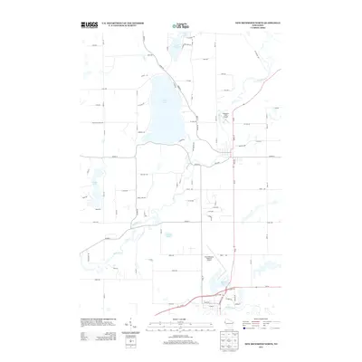
2013 Map of New Richmond North
USGS Topo · Published 2013About this map
Cedar Lake dominates the central portion of this landscape, serving as a focal point for the surrounding rural road network. The northern reaches of St. Croix County are defined by a glacial topography of numerous small bodies of water, including Pine Lake, Squaw Lake, and Hatfield Lake. Transport and infrastructure are prominent on this sheet, which documents the development of the New Richmond Regional Airport and Danielson Field Airport alongside the winding course of the Apple River. This river system, including Horse Cr and Cedar Cr, historically dictated the placement of early routes such as Co Hwy-M and Co Hwy-C. The map provides a clear look at the intersection of agricultural land and modern aviation facilities just north of the city center.
Find a feature on this map
84 named features on this map. Tap any name to fly to it.
Don’t see what you’re looking for? This feature index may not catch every label — zoom into the map to look around manually.
Map Details
Editions of this 2013 New Richmond North Map
This is the sole edition of this map. No revisions or reprints were ever made.
Other maps of this area

1900 · St Croix Dalles
USGS Topo · 1:62,500

1901 · St Croix Dalles
USGS Topo · 1:62,500

1948 · New Richmond
USGS Topo · 1:62,500

1949 · New Richmond
USGS Topo · 1:62,500

1950 · Deer Park
USGS Topo · 1:62,500

1950 · Balsam Lake
USGS Topo · 1:62,500

1953 · Stillwater
USGS Topo · 1:250,000

1955 · St. Croix Dalles
USGS Topo · 1:62,500

1955 · Stillwater
USGS Topo · 1:250,000

1958 · Stillwater
USGS Topo · 1:250,000