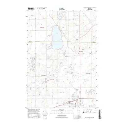
2015 Map of New Richmond North
USGS Topo · Published 2015About this map
Cedar Lake dominates the upper central portion of this Wisconsin landscape, where the boundary between Polk and St. Croix counties intersects its southern shores. This terrain is defined by its glacial hydrology, featuring a chain of water bodies including Lower Pine Lake, Strand Lake, and the expansive Hatfield Lake further south. The Apple River meanders through the eastern half of the quadrangle, passing the settlement of Star Prairie and the community at Huntington. The southern edge of the survey reaches the outskirts of New Richmond, where the New Richmond Regional Airport and Willow River are prominent. The land division follows a clear grid pattern, established by early surveying, which remains visible through rural road names like Goose Lake Rd and Old Mill Rd. Local heritage is anchored by landmarks such as Oakland Cem and the small residential cluster of Johannesburg.
Find a feature on this map
61 named features on this map. Tap any name to fly to it.
Don’t see what you’re looking for? This feature index may not catch every label — zoom into the map to look around manually.
Map Details
Editions of this 2015 New Richmond North Map
This is the sole edition of this map. No revisions or reprints were ever made.
Other maps of this area

1900 · St Croix Dalles
USGS Topo · 1:62,500

1901 · St Croix Dalles
USGS Topo · 1:62,500

1948 · New Richmond
USGS Topo · 1:62,500

1949 · New Richmond
USGS Topo · 1:62,500

1950 · Deer Park
USGS Topo · 1:62,500

1950 · Balsam Lake
USGS Topo · 1:62,500

1953 · Stillwater
USGS Topo · 1:250,000

1955 · St. Croix Dalles
USGS Topo · 1:62,500

1955 · Stillwater
USGS Topo · 1:250,000

1958 · Stillwater
USGS Topo · 1:250,000