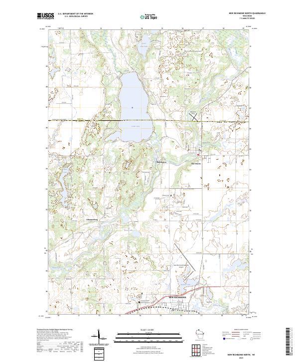
2023 Map of New Richmond North
USGS Topo · Published 2023About this map
The Apple River and Willow River basins define the landscape north of New Richmond, where glacial lakes and conservation lands dominate the topography. This 2023 survey highlights the extensive Saint Croix County Waterfowl Production Area and its counterpart in neighboring Polk County, illustrating a modern commitment to wetland preservation along the flyway. The settlement pattern shows the northward expansion of New Richmond near Hatfield Lake, while smaller clusters like Huntington, Star Prairie, and Johannesburg maintain their distinct character.
Find a feature on this map
72 named features on this map. Tap any name to fly to it.
Don’t see what you’re looking for? This feature index may not catch every label — zoom into the map to look around manually.
Map Details
Editions of this 2023 New Richmond North Map
This is the sole edition of this map. No revisions or reprints were ever made.
Other maps of this area

1900 · St Croix Dalles
USGS Topo · 1:62,500

1901 · St Croix Dalles
USGS Topo · 1:62,500

1948 · New Richmond
USGS Topo · 1:62,500

1949 · New Richmond
USGS Topo · 1:62,500

1950 · Deer Park
USGS Topo · 1:62,500

1950 · Balsam Lake
USGS Topo · 1:62,500

1953 · Stillwater
USGS Topo · 1:250,000

1955 · St. Croix Dalles
USGS Topo · 1:62,500

1955 · Stillwater
USGS Topo · 1:250,000

1958 · Stillwater
USGS Topo · 1:250,000