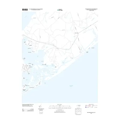
2013 Map of New River Inlet
USGS Topo · Published 2013About this map
Camp Lejeune dominates this coastal landscape, where the New River meets the Atlantic Ocean. The interplay of salt marshes, tidal channels, and military training grounds is evident in the complex hydrography of Howard Bay, Mile Hammock Bay, and the treacherous Hell Gate Creek. Strategic coastal access points like Hurst Ferry and Onslow Beach contrast with inland settlements such as Marines and Duck Creek, showing the integration of defense infrastructure with existing maritime communities. Along the southern barrier island, residential developments at North Topsail Shores and Chadwick Acres align with New River Inlet, a critical geographic feature for local navigation. The presence of numerous family-named points and bluffs, such as Wilkins Bluff and Harvey Point, highlights the enduring local heritage within the bounds of the federal reservation.
Find a feature on this map
73 named features on this map. Tap any name to fly to it.
Don’t see what you’re looking for? This feature index may not catch every label — zoom into the map to look around manually.
Map Details
Editions of this 2013 New River Inlet Map
This is the sole edition of this map. No revisions or reprints were ever made.
Other maps of this area

1942 · Spicer Bay
USGS Topo · 1:62,500

1942 · Swansboro
USGS Topo · 1:62,500

1948 · Swansboro
USGS Topo · 1:62,500

1948 · New River
USGS Topo · 1:62,500

1952 · Hubert
USGS Topo · 1:24,000

1952 · Camp Lejeune
USGS Topo · 1:24,000

1952 · Jacksonville South
USGS Topo · 1:24,000

1952 · Browns Inlet
USGS Topo · 1:24,000

1952 · Spicer Bay
USGS Topo · 1:24,000

1952 · New River Inlet
USGS Topo · 1:24,000
Featured Places
- North Topsail Beach, NC
- Peru, NC
- Marine Corps Base Camp Lejeune, NC
- Chadwick Acres, NC
- Duck Creek, Marine Corps Base Camp Lejeune