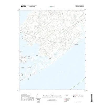
2019 Map of New River Inlet
USGS Topo · Published 2019About this map
North Topsail Beach and the surrounding coastal landscape of Topsail Island dominate this 2019 survey, illustrating the complex intersection of maritime commerce and residential development. The Intracoastal Waterway cuts behind the barrier islands, separating the beach communities from the mainland settlements of Marines and Peru. Inland, the terrain is defined by a dense network of tidal creeks including Duck Creek, Frenchs Creek, and Gillets Creek, which drain into the broad waters of the New River. The map provides detailed tracking of the shifting shoreline around New River Inlet and the marshy expanses of Traps Bay and Salliers Bay. These hydrographic features highlight the dynamic nature of the Onslow County coast, where navigation channels like Wards Channel and Hell Gate Creek remain vital to the local maritime economy and geography.
Find a feature on this map
71 named features on this map. Tap any name to fly to it.
Don’t see what you’re looking for? This feature index may not catch every label — zoom into the map to look around manually.
Map Details
Editions of this 2019 New River Inlet Map
This is the sole edition of this map. No revisions or reprints were ever made.
Other maps of this area

1942 · Spicer Bay
USGS Topo · 1:62,500

1942 · Swansboro
USGS Topo · 1:62,500

1948 · Swansboro
USGS Topo · 1:62,500

1948 · New River
USGS Topo · 1:62,500

1952 · Hubert
USGS Topo · 1:24,000

1952 · Camp Lejeune
USGS Topo · 1:24,000

1952 · Jacksonville South
USGS Topo · 1:24,000

1952 · Browns Inlet
USGS Topo · 1:24,000

1952 · Spicer Bay
USGS Topo · 1:24,000

1952 · New River Inlet
USGS Topo · 1:24,000
Featured Places
- North Topsail Beach, NC
- Peru, NC
- Marine Corps Base Camp Lejeune, NC
- Chadwick Acres, NC
- Duck Creek, Marine Corps Base Camp Lejeune