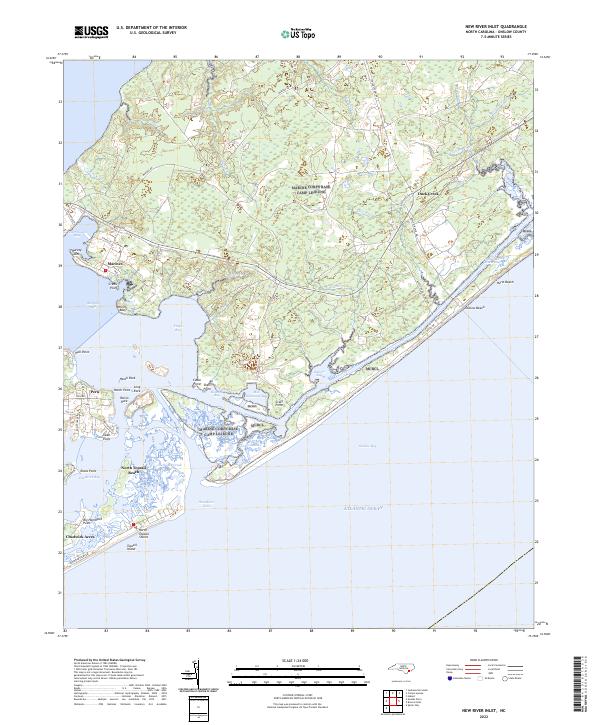
2022 Map of New River Inlet
USGS Topo · Published 2022About this map
New River Inlet serves as the gateway between the open waters of the Atlantic Ocean and the intricate coastal estuaries of Onslow County. This coastal landscape is defined by its extensive barrier island system, including Topsail Island and Onslow Beach, which buffer a network of sounds and bays such as Traps Bay, Howard Bay, and Salliers Bay. The Intracoastal Waterway threads through these protected waters, providing a vital maritime corridor for the region. On the mainland, small settlements like Marines and Peru sit near the tidal marshes, while North Topsail Beach marks the developed edge of the barrier islands. The geography is shaped by numerous points and bluffs, such as Wilkins Bluff and Swan Point, highlighting the complex interaction between the river outlets and the sea. The presence of features like Hatch Rock and Long Rock within the bays illustrates the hazards and landmarks crucial to local navigation.
Find a feature on this map
64 named features on this map. Tap any name to fly to it.
Don’t see what you’re looking for? This feature index may not catch every label — zoom into the map to look around manually.
Map Details
Editions of this 2022 New River Inlet Map
This is the sole edition of this map. No revisions or reprints were ever made.
Other maps of this area

1942 · Spicer Bay
USGS Topo · 1:62,500

1942 · Swansboro
USGS Topo · 1:62,500

1948 · Swansboro
USGS Topo · 1:62,500

1948 · New River
USGS Topo · 1:62,500

1952 · Hubert
USGS Topo · 1:24,000

1952 · Camp Lejeune
USGS Topo · 1:24,000

1952 · Jacksonville South
USGS Topo · 1:24,000

1952 · Browns Inlet
USGS Topo · 1:24,000

1952 · Spicer Bay
USGS Topo · 1:24,000

1952 · New River Inlet
USGS Topo · 1:24,000
Featured Places
- North Topsail Beach, NC
- Peru, NC
- Chadwick Acres, NC
- Duck Creek, Marine Corps Base Camp Lejeune
- Marine Corps Base Camp Lejeune, NC