
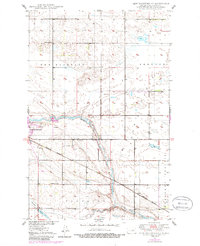
1950 Map of New Rockford NE
USGS Topo · Published 1950About this map
The James River meanders through the heart of this mid-century landscape, defining the agricultural and industrial character of Eddy County. Just east of the New Rockford city boundary, the terrain transitions into the broad reaches of Pleasant Prairie and Superior. The influence of the Great Northern railroad is evident, providing the essential transport link for local commerce and the small settlement of Dundas.
Find a feature on this map
17 named features on this map. Tap any name to fly to it.
Don’t see what you’re looking for? This feature index may not catch every label — zoom into the map to look around manually.
Map Details
Editions of this 1950 New Rockford NE Map
2 editions found
Other maps of this area

1928 · Tokio
USGS Topo · 1:62,500

1931 · Oberon
USGS Topo · 1:62,500

1931 · Tokio
USGS Topo · 1:62,500

1944 · Brantford
USGS Topo · 1:62,500

1946 · Brantford
USGS Topo · 1:62,500

1948 · New Rockford
USGS Topo · 1:62,500

1950 · New Rockford
USGS Topo · 1:24,000

1950 · Oberon SW
USGS Topo · 1:24,000

1950 · Brantford NW
USGS Topo · 1:24,000

1950 · Sheyenne
USGS Topo · 1:24,000