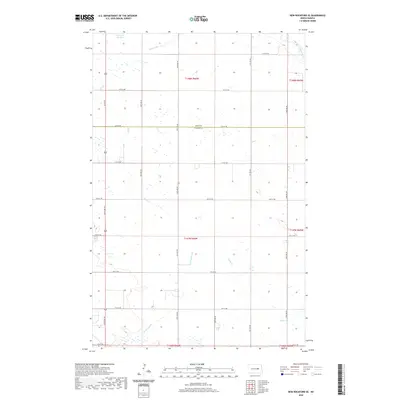
2020 Map of New Rockford SE
USGS Topo · Published 2020About this map
James River headwaters meander through the northeastern corner of this Foster County landscape, part of a sprawling network of prairie potholes and drainage ways. The terrain is defined by its seasonal hydrology, where features like Schwoebel Slough, Scotts Slough, and Rocky Run collect runoff across the glacial till. A rigid grid of section lines and gravel roads, including 12th St NE which marks the boundary between Eddy and Foster Counties, reveals the enduring impact of the Public Land Survey System on North Dakota's agricultural layout. Small, unnamed wetlands are scattered throughout the townships, illustrating the complex water table that supports the region's farming economy. Apart from the natural drainage of Kelly Cr, the map is dominated by large-scale field divisions and the straight-line paths of rural avenues such as 67th Ave NE and 72nd Ave NE.
Find a feature on this map
28 named features on this map. Tap any name to fly to it.
Don’t see what you’re looking for? This feature index may not catch every label — zoom into the map to look around manually.
Map Details
Editions of this 2020 New Rockford SE Map
This is the sole edition of this map. No revisions or reprints were ever made.
Other maps of this area

1900 · Pingree
USGS Topo · 1:125,000

1944 · Brantford
USGS Topo · 1:62,500

1946 · Brantford
USGS Topo · 1:62,500

1948 · New Rockford
USGS Topo · 1:62,500

1948 · Carrington
USGS Topo · 1:62,500

1950 · Carrington East
USGS Topo · 1:24,000

1950 · New Rockford
USGS Topo · 1:24,000

1950 · New Rockford NE
USGS Topo · 1:24,000

1950 · Brantford NW
USGS Topo · 1:24,000

1950 · Brantford
USGS Topo · 1:24,000