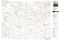
1981 Map of New Rockford
USGS Topo · Published 1981About this map
The Fort Totten Indian Reservation occupies the northeastern corner of this central North Dakota landscape, where the prairie is defined by the headwaters of the James River and the meandering path of the Sheyenne River. In the early 1980s, the region's agricultural character is evidenced by numerous gravel pits and a network of National Waterfowl Production Areas that protect the numerous glacial potholes and sloughs, such as Rosefield Slough and Schuobel Slough. The Burlington Northern railroad serves as the primary artery for the prairie towns, connecting established grain centers like Fessenden, New Rockford, and Harvey. Smaller settlements such as Heimdal, Bremen, and Cathay dot the rail lines, while landmarks like Butte De Morale and Black Hammer Hill provide relief in the otherwise steady terrain of the Tiffany Flats.
Find a feature on this map
73 named features on this map. Tap any name to fly to it.
Don’t see what you’re looking for? This feature index may not catch every label — zoom into the map to look around manually.
Map Details
Editions of this 1981 New Rockford Map
This is the sole edition of this map. No revisions or reprints were ever made.
Other maps of this area

1900 · Pingree
USGS Topo · 1:125,000

1928 · Tokio
USGS Topo · 1:62,500

1931 · Oberon
USGS Topo · 1:62,500

1931 · Tokio
USGS Topo · 1:62,500

1931 · Devils Lake
USGS Topo · 1:62,500

1932 · Flora
USGS Topo · 1:62,500

1932 · Grahams Island
USGS Topo · 1:62,500

1940 · Aylmer
USGS Topo · 1:62,500

1941 · Selz
USGS Topo · 1:62,500

1943 · Maddock
USGS Topo · 1:62,500