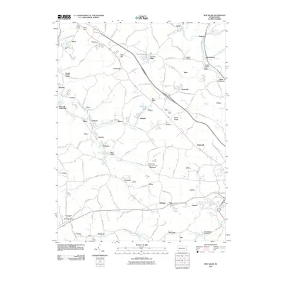
2010 Map of New Salem
USGS Topo · Published 2010About this map
Searights and the nearby Old Toll House anchor a landscape defined by the deep-rooted mining and industrial settlements of Fayette County. This 2010 survey illustrates the dense network of coal-patch towns like Tower Hill Number One, Buffington, and Keisterville that grew around the region's historic extraction operations. The terrain is carved by the Dunlap Creek watershed, where industrial remnants like the Allison Dam and Royal Reservoir Dam appear alongside more modern recreational additions including the Colonial Golf Course. For genealogists, the map is particularly useful for locating several family and community burial grounds, such as Tomasza Cemetery and Saint Peters Cemetery, situated among the winding country roads like Bukovit Farm Rd and Sunshine Hollow Rd.
Find a feature on this map
132 named features on this map. Tap any name to fly to it.
Don’t see what you’re looking for? This feature index may not catch every label — zoom into the map to look around manually.
Map Details
Editions of this 2010 New Salem Map
This is the sole edition of this map. No revisions or reprints were ever made.
Other maps of this area

1900 · Uniontown
USGS Topo · 1:62,500

1900 · Masontown
USGS Topo · 1:62,500

1902 · Brownsville
USGS Topo · 1:62,500

1902 · Connellsville
USGS Topo · 1:62,500

1903 · Masontown
USGS Topo · 1:62,500

1906 · Brownsville
USGS Topo · 1:62,500

1931 · Brownsville
USGS Topo · 1:62,500

1931 · Connellsville
USGS Topo · 1:62,500

1931 · Uniontown
USGS Topo · 1:62,500

1931 · Masontown
USGS Topo · 1:62,500
Featured Places
- Luzerne Township, PA
- North Union Township, PA
- German Township, PA
- Georges Township, PA
- Menallen Township, PA