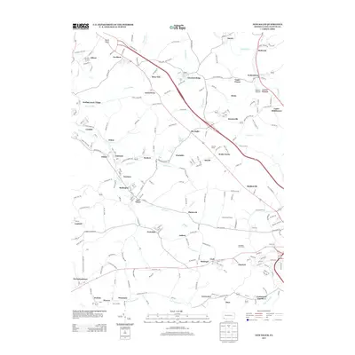
2013 Map of New Salem
USGS Topo · Published 2013About this map
New Salem and its surrounding Fayette County coal-country villages appear in meticulous detail on this early 21st-century map. The landscape is defined by the dense clustering of settlements like Brier Hill, Keisterville, and Davidson, reflecting the area's legacy of industrial residential patterns. The Old Toll House stands as a landmark of earlier transit history near Rocks Works, while the winding course of Dunlap Cr and its tributaries, including Saltlick Run, carve through the terrain. Evidence of the region’s transportation network is found at Ache Junction in the south and the highway corridors that connect Sea Right and Haddenville. Modern land use is visible in recreational developments such as Colonial Golf Course, contrasting with the numerous small-scale communities like Upper Peanut and Lower Peanut that dot the valleys near Redstone Cr.
Find a feature on this map
210 named features on this map. Tap any name to fly to it.
Don’t see what you’re looking for? This feature index may not catch every label — zoom into the map to look around manually.
Map Details
Editions of this 2013 New Salem Map
This is the sole edition of this map. No revisions or reprints were ever made.
Other maps of this area

1900 · Uniontown
USGS Topo · 1:62,500

1900 · Masontown
USGS Topo · 1:62,500

1902 · Brownsville
USGS Topo · 1:62,500

1902 · Connellsville
USGS Topo · 1:62,500

1903 · Masontown
USGS Topo · 1:62,500

1906 · Brownsville
USGS Topo · 1:62,500

1931 · Brownsville
USGS Topo · 1:62,500

1931 · Connellsville
USGS Topo · 1:62,500

1931 · Uniontown
USGS Topo · 1:62,500

1931 · Masontown
USGS Topo · 1:62,500
Featured Places
- Luzerne Township, PA
- North Union Township, PA
- German Township, PA
- Georges Township, PA
- Menallen Township, PA