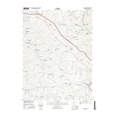
2016 Map of New Salem
USGS Topo · Published 2016About this map
The National Pike cuts a historic diagonal through this portion of Fayette County, serving as the primary corridor for a dense network of coal-patch towns and rural settlements. This landscape is defined by its industrial heritage and close-knit communities, where places like Tower Hill Number One, Keisterville, and Brier Hill established deep roots along the undulating terrain. The area's genealogical significance is anchored by numerous burial grounds, including Saint Peters Cem and Grace Cem, which sit alongside the residential clusters of Republic and New Salem. Water resources are centrally managed via the Dunlap Creek Watershed Reservoir and Pa-470 Reservoir, while the northern reaches are drained by Redstone Creek and Colvin Run. This map captures the modern footprint of a region built on extractive industry, evidenced by the clustered housing of Rocks Works and the enduring importance of transit routes like the National Pike.
Find a feature on this map
166 named features on this map. Tap any name to fly to it.
Don’t see what you’re looking for? This feature index may not catch every label — zoom into the map to look around manually.
Map Details
Editions of this 2016 New Salem Map
This is the sole edition of this map. No revisions or reprints were ever made.
Other maps of this area

1900 · Uniontown
USGS Topo · 1:62,500

1900 · Masontown
USGS Topo · 1:62,500

1902 · Brownsville
USGS Topo · 1:62,500

1902 · Connellsville
USGS Topo · 1:62,500

1903 · Masontown
USGS Topo · 1:62,500

1906 · Brownsville
USGS Topo · 1:62,500

1931 · Brownsville
USGS Topo · 1:62,500

1931 · Connellsville
USGS Topo · 1:62,500

1931 · Uniontown
USGS Topo · 1:62,500

1931 · Masontown
USGS Topo · 1:62,500
Featured Places
- Luzerne Township, PA
- North Union Township, PA
- German Township, PA
- Georges Township, PA
- Menallen Township, PA