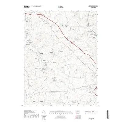
2019 Map of New Salem
USGS Topo · Published 2019About this map
New Salem and the surrounding coal-country settlements of Fayette County appear here in a landscape dense with cultural and religious history. The map detail highlights an extraordinary concentration of parish life and family burial grounds, including the Saint Mary Assumption Byzantine Catholic Cem and Holy Trinity Orthodox Church Cem. These features reflect the diverse immigrant heritage of the region's industrial labor force. The geography is defined by a network of small hamlets like Footedale, Keisterville, and Brier Hill that grew along the National Pike. This roadway serves as a central artery through a terrain carved by Dunlap Creek and Redstone Creek. From the institutional grounds of Lafayette Memorial Park to the smaller family plots like Moore Cem, the map provides a precise record of the communities that shaped the coal and coke era of Western Pennsylvania.
Find a feature on this map
182 named features on this map. Tap any name to fly to it.
Don’t see what you’re looking for? This feature index may not catch every label — zoom into the map to look around manually.
Map Details
Editions of this 2019 New Salem Map
This is the sole edition of this map. No revisions or reprints were ever made.
Other maps of this area

1900 · Uniontown
USGS Topo · 1:62,500

1900 · Masontown
USGS Topo · 1:62,500

1902 · Brownsville
USGS Topo · 1:62,500

1902 · Connellsville
USGS Topo · 1:62,500

1903 · Masontown
USGS Topo · 1:62,500

1906 · Brownsville
USGS Topo · 1:62,500

1931 · Brownsville
USGS Topo · 1:62,500

1931 · Connellsville
USGS Topo · 1:62,500

1931 · Uniontown
USGS Topo · 1:62,500

1931 · Masontown
USGS Topo · 1:62,500
Featured Places
- Luzerne Township, PA
- North Union Township, PA
- German Township, PA
- Georges Township, PA
- Menallen Township, PA