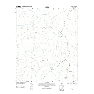
2011 Map of New Site
USGS Topo · Published 2011About this map
Piedmont Upland terrain characterizes this portion of Tallapoosa County, where the community of New Site serves as a central hub for several smaller settlements and rural crossroads. The landscape is defined by the winding paths of Enitachopco Creek and Osborn Creek, which drain the area surrounding Hog Mountain. For genealogists and local historians, the sheet is particularly valuable for its documentation of numerous burial grounds, including Bethlehem Cemetery, Old Salem Cemetery, and New Hope Cemetery, which are scattered throughout the countryside near Cowpens and Perryville.
Find a feature on this map
71 named features on this map. Tap any name to fly to it.
Don’t see what you’re looking for? This feature index may not catch every label — zoom into the map to look around manually.
Map Details
Editions of this 2011 New Site Map
This is the sole edition of this map. No revisions or reprints were ever made.
Other maps of this area

1891 · Ashland
USGS Topo · 1:125,000

1906 · Dadeville
USGS Topo · 1:125,000

1953 · Atlanta
USGS Topo · 1:250,000

1955 · Phenix City
USGS Topo · 1:250,000

1957 · Phenix City
USGS Topo · 1:250,000

1957 · Atlanta
USGS Topo · 1:250,000

1958 · Phenix City
USGS Topo · 1:250,000

1958 · Atlanta
USGS Topo · 1:250,000

1969 · New Site
USGS Topo · 1:24,000
1969 · Millerville
USGS Topo · 1:24,000