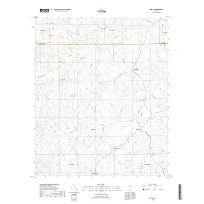
2018 Map of New Site
USGS Topo · Published 2018About this map
New Site and the surrounding Tallapoosa County uplands are defined by a network of rural settlements and family cemeteries that mark the historical footprint of East Alabama. The landscape is dominated by the prominent elevation of Hog Mtn, which overlooks a complex drainage system including Enitachopco Creek and its many tributaries like Rotton Cr and Rocky Cr. These waterways historically guided the placement of early communities such as Goldville and Cowpens, which remain connected by a web of local roads like Flyers Mill Rd and Valley Grove Rd.
Find a feature on this map
89 named features on this map. Tap any name to fly to it.
Don’t see what you’re looking for? This feature index may not catch every label — zoom into the map to look around manually.
Map Details
Editions of this 2018 New Site Map
This is the sole edition of this map. No revisions or reprints were ever made.
Other maps of this area

1891 · Ashland
USGS Topo · 1:125,000

1906 · Dadeville
USGS Topo · 1:125,000

1953 · Atlanta
USGS Topo · 1:250,000

1955 · Phenix City
USGS Topo · 1:250,000

1957 · Phenix City
USGS Topo · 1:250,000

1957 · Atlanta
USGS Topo · 1:250,000

1958 · Phenix City
USGS Topo · 1:250,000

1958 · Atlanta
USGS Topo · 1:250,000

1969 · New Site
USGS Topo · 1:24,000
1969 · Millerville
USGS Topo · 1:24,000