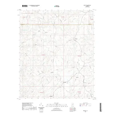
2020 Map of New Site
USGS Topo · Published 2020About this map
New Site and the surrounding Tallapoosa County uplands are characterized by a dense network of small family cemeteries and winding creek valleys. This 2020 survey records the enduring rural landscape of east-central Alabama, where historic burial grounds like Old Salem Cem, Bethlehem Cem, and Hutchinson Cem are scattered among the ridges. The terrain is dominated by high points such as Hog Mtn and an intricate drainage system including Enitachopco Creek and Timbergut Cr. Small communities like Goldville, Perryville, and Cowpens serve as local landmarks along the secondary road network. The map reveals a transition between the Clay Co border and the interior of Tallapoosa County, with private water features like Patterson Lake providing focal points in an area otherwise defined by timbered hills and the natural flow of branches like Dewberry Br and Turkey Br.
Find a feature on this map
89 named features on this map. Tap any name to fly to it.
Don’t see what you’re looking for? This feature index may not catch every label — zoom into the map to look around manually.
Map Details
Editions of this 2020 New Site Map
This is the sole edition of this map. No revisions or reprints were ever made.
Other maps of this area

1891 · Ashland
USGS Topo · 1:125,000

1906 · Dadeville
USGS Topo · 1:125,000

1953 · Atlanta
USGS Topo · 1:250,000

1955 · Phenix City
USGS Topo · 1:250,000

1957 · Phenix City
USGS Topo · 1:250,000

1957 · Atlanta
USGS Topo · 1:250,000

1958 · Phenix City
USGS Topo · 1:250,000

1958 · Atlanta
USGS Topo · 1:250,000

1969 · New Site
USGS Topo · 1:24,000
1969 · Millerville
USGS Topo · 1:24,000