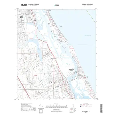
2018 Map of New Smyrna Beach
USGS Topo · Published 2018About this map
New Smyrna Beach and the surrounding Volusia County coastline are depicted here at a period of established coastal development and intricate waterway navigation. The landscape is defined by the Intracoastal Waterway and the Indian River Lagoon, which separate the mainland from the barrier island communities of Wilbur-by-the-Sea and Ponce Park. Local history is deeply embedded in the map through numerous small burial grounds and landmarks, including the Dummit Gravesite and the Ponce Inlet Lighthouse Site near Ponce Inlet.
Find a feature on this map
118 named features on this map. Tap any name to fly to it.
Don’t see what you’re looking for? This feature index may not catch every label — zoom into the map to look around manually.
Map Details
Editions of this 2018 New Smyrna Beach Map
This is the sole edition of this map. No revisions or reprints were ever made.
Other maps of this area

1937 · Port Orange
USGS Topo · 1:48,000

1943 · Port Orange
USGS Topo · 1:62,500

1944 · Port Orange
USGS Topo · 1:62,500

1950 · Ariel
USGS Topo · 1:24,000

1950 · Edgewater
USGS Topo · 1:24,000

1952 · Samsula
USGS Topo · 1:24,000

1952 · Daytona Beach
USGS Topo · 1:24,000

1954 · Daytona Beach
USGS Topo · 1:250,000

1955 · Orlando
USGS Topo · 1:250,000

1956 · Port Orange
USGS Topo · 1:24,000