1956 Map of Port Orange
USGS Topo · Published 1960About this map
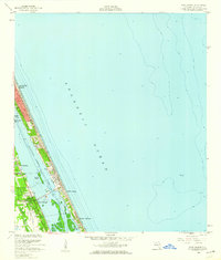
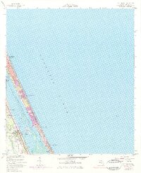
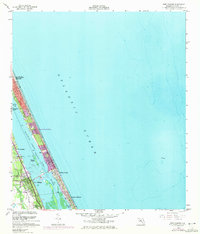
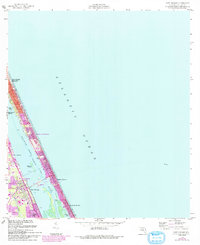
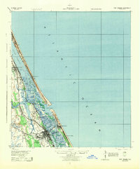
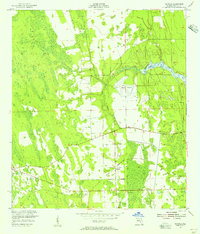
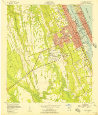
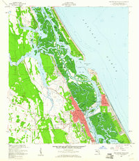
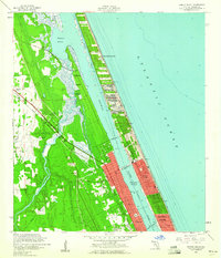
The Halifax River and the Intracoastal Waterway define this mid-century coastal corridor, separating the mainland settlements from the slender barrier island. Growth is concentrated along the riverbanks in Port Orange, South Daytona, and Allandale, where the Florida East Coast railway runs parallel to the shore. On the island, the small community of Wilbur-by-the-Sea and the development at Halifax Estates sit between the river and the Atlantic Ocean.
Find a feature on this map
17 named features on this map. Tap any name to fly to it.
Don’t see what you’re looking for? This feature index may not catch every label — zoom into the map to look around manually.
Map Details
Editions of this 1956 Port Orange Map
4 editions found
Other maps of this area

1937 · Port Orange
USGS Topo · 1:48,000

1937 · Ormond
USGS Topo · 1:48,000

1943 · Port Orange
USGS Topo · 1:62,500

1944 · Ormond
USGS Topo · 1:62,500
1944 · Port Orange
USGS Topo · 1:62,500
1952 · Samsula
USGS Topo · 1:24,000
1952 · Daytona Beach
USGS Topo · 1:24,000

1954 · Daytona Beach
USGS Topo · 1:250,000
1956 · New Smyrna Beach
USGS Topo · 1:24,000
1956 · Ormond Beach
USGS Topo · 1:24,000
Featured Places
- Daytona Beach, FL
- Daytona Beach Shores, FL
- Port Orange, FL
- Halifax Estates, Daytona Beach Shores
- Wilbur-by-the-Sea, FL