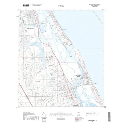
2021 Map of New Smyrna Beach
USGS Topo · Published 2021About this map
New Smyrna Beach and its surrounding coastal hamlets are defined by a complex network of saltwater lagoons and narrow inland waterways. The landscape centers on the confluence of the Halifax River and the Indian River North at the Ponce de Leon Inlet, a dynamic point of coastal navigation. Residential development in Allandale, Harbor Oaks, and Mission City is bounded by preserved natural areas like the Doris Leeper Spruce Creek Preserve Trl, while the town's beachside character is emphasized by the Worlds Most Famous Beach Trl along the Atlantic shore.
Find a feature on this map
81 named features on this map. Tap any name to fly to it.
Don’t see what you’re looking for? This feature index may not catch every label — zoom into the map to look around manually.
Map Details
Editions of this 2021 New Smyrna Beach Map
This is the sole edition of this map. No revisions or reprints were ever made.
Other maps of this area

1937 · Port Orange
USGS Topo · 1:48,000

1943 · Port Orange
USGS Topo · 1:62,500

1944 · Port Orange
USGS Topo · 1:62,500

1950 · Ariel
USGS Topo · 1:24,000

1950 · Edgewater
USGS Topo · 1:24,000

1952 · Samsula
USGS Topo · 1:24,000

1952 · Daytona Beach
USGS Topo · 1:24,000

1954 · Daytona Beach
USGS Topo · 1:250,000

1955 · Orlando
USGS Topo · 1:250,000

1956 · Port Orange
USGS Topo · 1:24,000