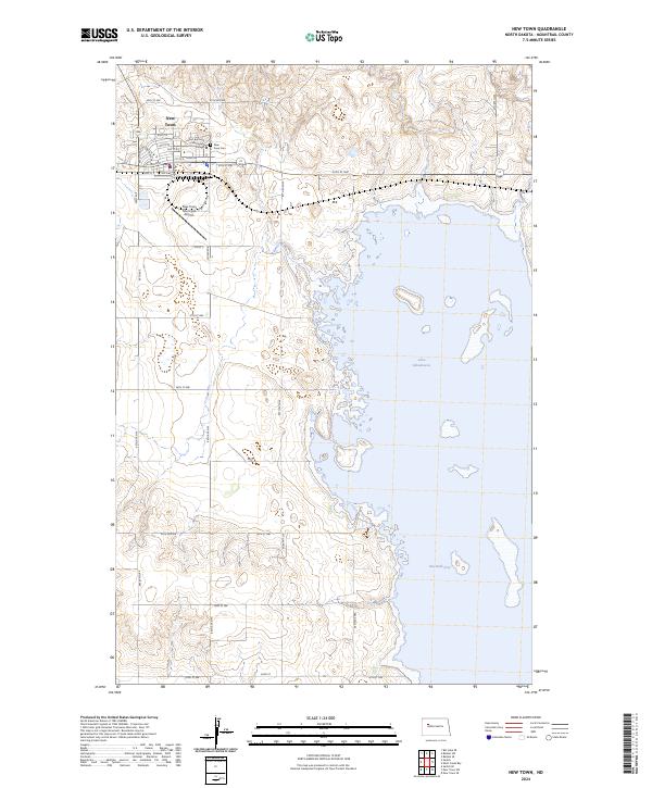
2024 Map of New Town
USGS Topo · Published 2024About this map
New Town sits on the high ground of the Missouri Plateau, organized along a grid where Main St and Eagle Dr serve as central arteries for this modern North Dakota community. To the south and east, the landscape is dominated by the sprawling waters of Lake Sakakawea, which fills the valley and creates the prominent Van Hook Arm. This map illustrates the intersection of educational and civic life, showing the campus of Fort Berthold Community College and the New Town Municipal Airport on the town's western edge. The local geography is a blend of residential development and the vast hydraulic system of the reservoir, with the New Town Cem positioned near the northern limits of the settlement. The rectilinear road network, including 40th St NW and 87th Ave NW, outlines the transition from the structured town center to the surrounding rural plains.
Find a feature on this map
33 named features on this map. Tap any name to fly to it.
Don’t see what you’re looking for? This feature index may not catch every label — zoom into the map to look around manually.
Map Details
Editions of this 2024 New Town Map
This is the sole edition of this map. No revisions or reprints were ever made.
