
1967 Map of New Town SW
USGS Topo · Published 1970About this map
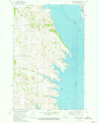
The Fort Berthold Indian Reservation Boundary defines much of the upper landscape in this late-1960s survey, marking a transition between high prairie and the sprawling waters of Lake Sakakawea. The inundation of the Missouri River valley is the dominant geographic feature, creating a complex, fingered shoreline that reaches deep into the draws of Little Shell Creek. This newly formed aquatic environment is managed in part by the Van Hook State Game Management Area, which covers significant portions of the peninsulas and eastern shore.
Find a feature on this map
16 named features on this map. Tap any name to fly to it.
Don’t see what you’re looking for? This feature index may not catch every label — zoom into the map to look around manually.
Map Details
Editions of this 1967 New Town SW Map
This is the sole edition of this map. No revisions or reprints were ever made.
Other maps of this area

1953 · Watford City
USGS Topo · 1:250,000

1957 · Watford City
USGS Topo · 1:250,000

1967 · Watford City
USGS Topo · 1:250,000

1967 · Sanish
USGS Topo · 1:24,000

1967 · Sanish SE
USGS Topo · 1:24,000

1967 · New Town SE
USGS Topo · 1:24,000

1970 · String Buttes
USGS Topo · 1:24,000
1970 · Saddle Butte
USGS Topo · 1:24,000
1970 · Mandaree NE
USGS Topo · 1:24,000

1981 · New Town
USGS Topo · 1:24,000