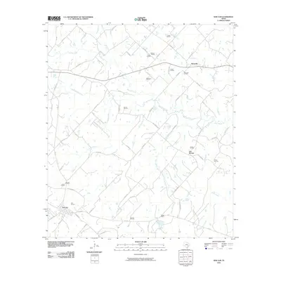
2010 Map of New Ulm
USGS Topo · Published 2010About this map
The agrarian landscape of Austin County is defined here by the headwaters of several drainages, including West Mill Creek and Sandy Creek. In the early 21st century, the region remains primarily rural, anchored by the long-established settlements of New Ulm and Nelsonville. The map reveals a dense network of family-named cemeteries, such as the Frnka Cemetery, Zettel Cemetery, and Shellburne Cemetery, which offer valuable geographic markers for genealogists tracing the Central Texas German and Czech heritage of the area. Industrial activity is present near the southern edge of the quadrangle at the New Ulm Oil Field, while the smaller community of New Bremen sits centrally near Dry Creek. This survey captures the transition from traditional farming to modern resource extraction, with features like the Butler Dam and various unnamed stock ponds scattered across the rolling drainage basins.
Find a feature on this map
70 named features on this map. Tap any name to fly to it.
Don’t see what you’re looking for? This feature index may not catch every label — zoom into the map to look around manually.
Map Details
Editions of this 2010 New Ulm Map
This is the sole edition of this map. No revisions or reprints were ever made.
Other maps of this area

1919 · Fayettsville
USGS Topo · 1:62,500

1930 · Brenham
USGS Topo · 1:62,500

1953 · Seguin
USGS Topo · 1:250,000

1954 · Austin
USGS Topo · 1:250,000

1956 · Bellville
USGS Topo · 1:62,500

1956 · Brenham
USGS Topo · 1:62,500

1958 · Seguin
USGS Topo · 1:250,000

1958 · Industry
USGS Topo · 1:24,000

1958 · Greenvine
USGS Topo · 1:24,000

1958 · Frelsburg
USGS Topo · 1:24,000