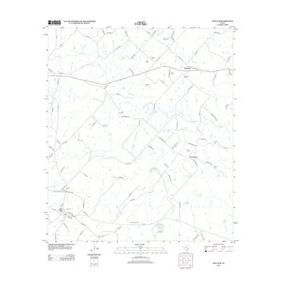
2013 Map of New Ulm
USGS Topo · Published 2013About this map
New Ulm and its surrounding rural countryside are defined by a network of creeks and numerous small family and community burial grounds. This 2013 landscape is carved by watercourses including W Mill Cr and Sandy Cr, which drain toward the south and east. The map reveals a high concentration of cemeteries reflecting the area's deep-rooted family history, such as Shellburne Cem, Hoppe Cem, and the National Cem. While agricultural use remains evident through the dense system of farm-to-market roads like FM-109 and FM-2502, the presence of the New Ulm Oil Field in the southern portion of the quadrangle points to the importance of the energy industry. Small clusters of habitation at Nelsonville and New Bremen connect the landscape, while family names like Zettel and Frnka are permanently etched into the local geography.
Find a feature on this map
110 named features on this map. Tap any name to fly to it.
Don’t see what you’re looking for? This feature index may not catch every label — zoom into the map to look around manually.
Map Details
Editions of this 2013 New Ulm Map
This is the sole edition of this map. No revisions or reprints were ever made.
Other maps of this area

1919 · Fayettsville
USGS Topo · 1:62,500

1930 · Brenham
USGS Topo · 1:62,500

1953 · Seguin
USGS Topo · 1:250,000

1954 · Austin
USGS Topo · 1:250,000

1956 · Bellville
USGS Topo · 1:62,500

1956 · Brenham
USGS Topo · 1:62,500

1958 · Seguin
USGS Topo · 1:250,000

1958 · Industry
USGS Topo · 1:24,000

1958 · Greenvine
USGS Topo · 1:24,000

1958 · Frelsburg
USGS Topo · 1:24,000